Wish I had thought of this. Recalling 1993, get it?
Tuesday, March 26, 2013
NYC 1993: Experimental Jet Set, Trash and No Star
Wish I had thought of this. Recalling 1993, get it?
Monday, March 11, 2013
The Memory of Napoleon
Coming to Terms With the Past | ||
| The Vendôme Column France went through several shifts in power over the course of the 19th century and the history of this column speaks to the concurrent attitude towards the recent history of the country. After the infamous initial revolution, Napoleon took power in a coup d'etat in 1801, declaring himself emperor in 1804. This column was initially created between 1806 and 1810, taking Trajan's Column as precedent. On top of the column stood a statue of Napoleon styled after a Roman Emperor. Of course, Napoleon's regime came to an end (for good this time) at Waterloo in 1815 and in 1816 with Paris occupied by Allied forces, an effort was made to tear down the gigantic glorification of the man but the column remained. The line of Louis the XVI (the King killed in the initial Revolution) was brought back into power with Louis XVIII and Charles X who promptly took down the statue of Napoleon and melted it down to create a statue to an ancestor. Charles X's successor, Louis-Phillipe (who, for those keeping score ended up settling on a Constitutional Monarchy after the Revolution of 1830 (the one memorialized by the famous DeLacroix painting)) put up another statue of Napoleon atop the column that portrayed him in modern dress, taking the myth of Napoleon down a notch. Alas, France was really just taste testing a Constitutional Monarchy and decided that it wasn't for them in 1848 and figured they might try out that whole Republic thing again and elected Louis-Napoleon, the Napoleon's nephew. And, for continuity's sake, Louis-Napoleon figured that he knew France really wanted an Empire and promptly only took three years to become dictator of the nation. The memory of his dear uncle was a little bit more important to him probably both due to respect and the fact that he gains credibility from him and precedent on the whole Emperor thing, so the statue that he placed at the top of the Vendôme Column was much more in line with the original in its style. Come 1871, people in France were ready for change again. Since the initial revolution they had gone from Republic to Empire to Monarchy to Republic to Empire but to really shake things up this time the Paris Commune was formed, the first notable communist experiment. With some animosity towards Napoleons in general, the Vendôme Column was not safe. Gustave Courbet, an amazing artist of the time suggested that the Column should be taken down and rebuilt within the Hôtel des Invalides, a complex dedicated to the military in general with museums as well as the tomb of Napoleon himself. This plan was rejected, possibly because it was too respectful, because the column was torn down.
|

Sunday, March 10, 2013
Prepared War Memorial by Jiho Won


Saturday, March 9, 2013
Iraq & Afghanistan War Memorial - Boston
This simple yet powerful memorial is placed quietly behind the Old North Church in the North End neighborhood of Boston. No plaque sits near it, it is just as seen below. There is one dog tag for each fallen soldier in the war. It fits well with the spirit of the adjacent Paul Revere Mall.

As far as I can tell, depressingly enough this initial set up was not sufficient to honor all of those who have given their lives so an extra panel awkwardly sits just to the right of the set up above.


The Cult of Paul Revere

Paul Revere - Pride of the North End in Boston, a link they will never forget. The plaque on the left is located on the front of the Old North Church in the heart of the North End of Boston, it reads, "The signal lanterns of Paul Revere displayed in the steeple of this church warned the country of the march of the British troops to Lexington and Concord". The story, made famous by the Henry Wadsworth Longfellow poem, Paul Revere's Ride in 1860 has become arguably one of American stories most shrouded in myth. On the axis between the Old North Church and St. Stephen's Church is the Paul Revere Mall complete with the famous Paul Revere statue. The plaque below on the right dedicates the space - it reads: "Paul Revere Mall established 1933 from the income of the George Robert White Fund bequeathed to the City of Boston for creating works of public utility and beauty. Dedicated to the enjoyment of the Community and to the memory of those men and women of the North End who helped to make Boston the pride of later generations." From this plaque, it seems that the mall was created as a public works project during the Great Depression - it was not a memorial created on whim because people felt that Paul Revere deserved a mall, rather it was created as a functional place for the community that just so happened to be related in name to a famous man from the area.


As time has passed, the mall has become an impromptu memorial for all those of the West End. The dedication plaque foreshadows this change in meaning perhaps. Paul Revere becomes the example to which all the people of the neighborhood aspire and those who are deemed worthy gain attention. Seeing all of these names might also inspire the people who see it to something noteworthy themselves.
 |
| Memorial for Patrolman Andrew B. Cuneo |
 |
| Memorial for citizens of the North End who have died in War |
In addition to all of this, Paul Revere's house has been maintained and still stands today not far from the location of the mall.

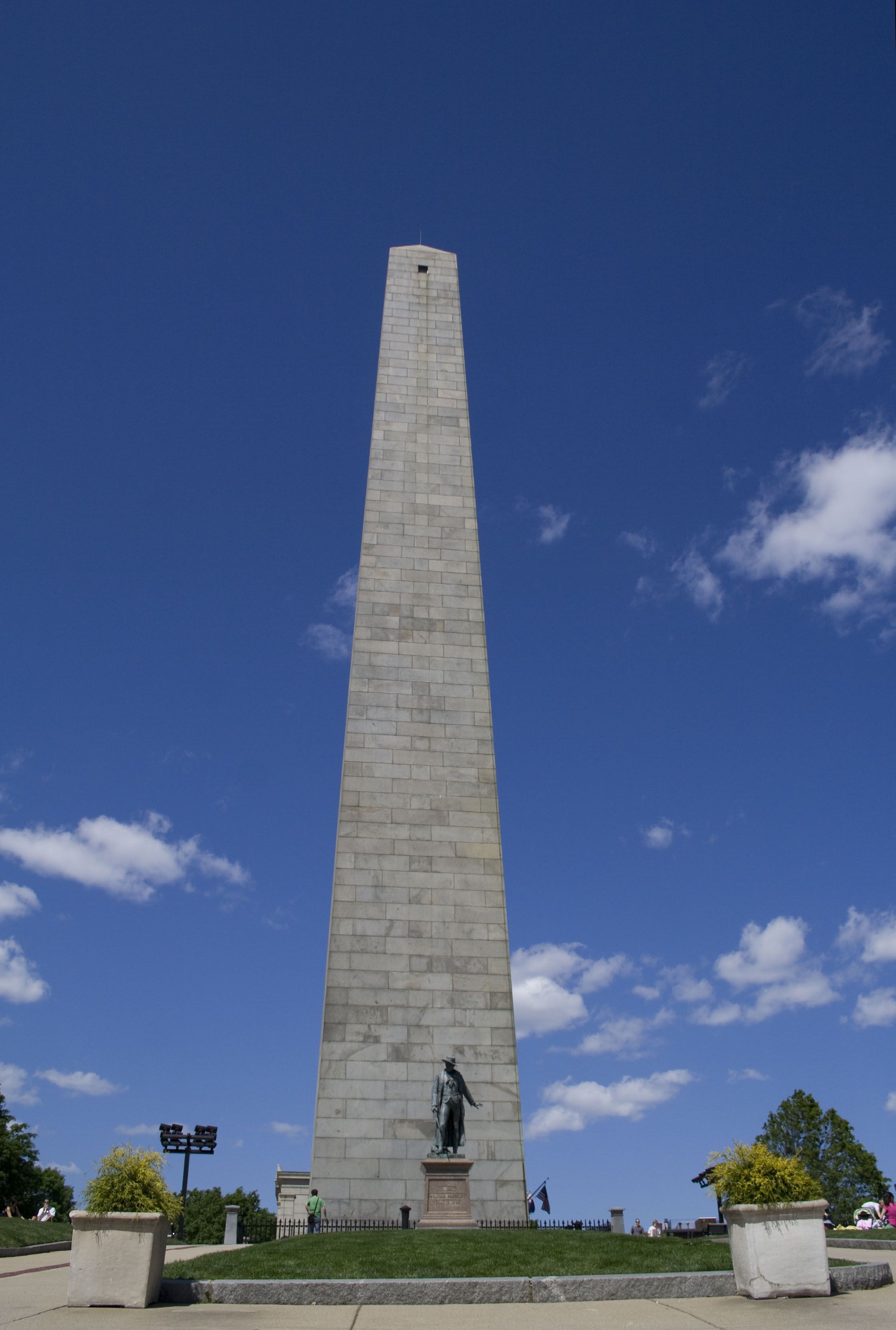
Bunker Hill Monument
Sunday, March 3, 2013
Doris Salcedo - Memorials in Museums


Friday, March 1, 2013
Digital Mapping, Controlling our Memory.
You can read the original on BuzzFeed here.
How Google And Bing Maps Control What You Can See
Behind the scenes of the most powerful maps in the history of the Earth. And how Google, Microsoft, DigitalGlobe, and the world's governments decide what does — and doesn't — belong on its surface.

In early February, Wired published a satellite photo of a desert structure in southern Saudi Arabia. The image, screencapped from Bing Maps, corresponded with a report that the CIA had built secret drone bases in the region. The site was available on any computer with a web browser, but appeared to be legit — Bing Maps, which is owned by Microsoft, had effectively outed a closely guarded intelligence secret.
If you went to the same location in Google Maps, however, you'd find nothing but desert.
A few months before, Bing Maps (as well as Apple Maps) had revealed a temporary replica of the compound in which Bin Laden was killed. The training facility was located thousands of miles away from the Arabian Peninsula, in North Carolina, but didn't show up on Google Maps either.
In both cases, Google and Microsoft were using imagery collected by the same satellites. Yet one reflected the reality on the ground, and the other didn't.
"Does anyone know," asked writer Adrian Chen shortly after the Wired post went up, "why Bing maps often shows sensitive satellite images censored by Google?"
It's a good question, but one we may never get a clear answer to — Microsoft, in fact, admits that it censors map data while Google vehemently — though narrowly — denies it.
But it's a question that also gets at a bigger problem with how digital maps get made, and who controls what makes it into your web browser. Maps censorship, it turns out, is very real — just not in the ways you think.
***
Asked directly if Microsoft censors satellite images, a spokesperson declined to offer specifics: "Microsoft follows a complex process for blurring that aligns with legal requirements for various countries," a spokesperson tells BuzzFeed. "Based on where, when, and how we acquire imagery the blurring procedure occurs at different points in our production pipelines. Due to various agreements with governments, Microsoft cannot comment on the specifics of blurring processes, algorithms, or procedures."
The spokesperson appeared to be referring to streetside imagery — that is, imagery collected on the ground, that might capture identifying information such as faces or license plates. But she clarified: "Yes, the [policy] applies to satellite imagery as well."
Google, on the other hand, officially denies that it censors map data, telling BuzzFeed, "in occasional instances in which we receive government requests to blur portions of our imagery, we are always open to discussing those requests with public agencies and local officials. To date, none of these conversations has resulted in our blurring any imagery."
But there's a serious caveat: "Google Earth is built from a broad range of imagery providers, including public, government, commercial and private sector sources -- some of which may blur images before they supply it to us."
But there's a serious caveat: "Google Earth is built from a broad range of imagery providers, including public, government, commercial and private sector sources -- some of which may blur images before they supply it to us."
Google owns the rights to what may be the most comprehensive and wide-ranging database of the Earth's surface ever recorded, but the company doesn't own a single satellite. To build its maps, Google licenses imagery from a handful of commercial satellite operators, the largest of which is Longmont, Colorado's DigitalGlobe. DigitalGlobe currently operates four satellites, with a fifth coming online next year, and submits new imagery to Google on a frequent basis; Bing, too, re-ups its data almost constantly, though its contract specifics and update demands are likely different from Google's, and unknown to its competitor .
Stefan Geens, technologist and longtime Google Earth expert, has been writing about commercial satellite imagery at his site, OgleEarth, for over five years. It's these differing contracts, he suspects, that account for Google's exclusion of the the drone base in Saudi Arabia.
It's most probably, he says, that "they have different update schedules, and Microsoft got the data a little bit earlier."
"It will be interesting to see if Google Earth updates in the next few weeks," he notes. Using the Google Mapmaker project, a Saudi Arabian citizen has already updated Google Maps' metadata to include an official placename for the base:

Screenshot snapped by Stefan Geens
Yet there is a second, far more intriguing possibility — to Google, rather than blurring imagery of a secret base at the behest of the U.S. or Saudi Arabian government, simply declined to update it. The base, which is in the middle of the desert, is just a few kilometers outside of a high resolution zone.
This, says Geens, is not a smoking gun. But it wouldn't be unprecedented. One of the few concrete examples of censorship-by-exclusion committed by Google was documented in 2007, when Google rolled back imagery in Basra, Iraq, after reports that insurgents had used it to attack British troops. Numerous tiles were rolled back to 2002-era, pre-war imagery, as documented extensively here.
At the time, a Google spokesperson was less defensive: "We have opened channels with the military in Iraq but we are not prepared to discuss what we have discussed with them. But we do listen and we are sensitive to requests."
Since then, evidence of an unofficial policy at Google has slowly mounted: "Ever since [Basra]," says Geens, "it's very difficult to find recent satellite imagery in Afghanistan and Iraq." This problem has been echoed elsewhere on multipleoccasions.
One strangely poetic post on Google's support forums, dated 2011, reads "Google please update Iraq's Satellite images. They are 7 years old and a lot has changed."
***
There are clear, well-documented cases censorship in both Google and Bing's maps. For example, take this royal Palace in Amsterdam:

The line between electing to use maps that come pre-censored and censoring maps yourself is, shall we say, a blurry one. Google's choice to use imagery from UK-based GeoInformation Group, which in turn gets its imagery from the Netherlands' TerraImaging, nets it sharper imagery of Amsterdam than other sources could provide. In fact, much of what Google Maps and Bing users see at higher zoom levels isn't actually satellite imagery but aerial imagery. Governments might not be able to control foreign satellites in space, but they can control planes in their airspace.
This desire for higher-res imagery brings with it censorship: government buildings, and buildings owned by the royal family, are blurred from view — a request fulfilled by TerraImaging before Google even had the option to license its imagery. And one that Google can maintain a distance from.
Observers have made a hobby of collecting examples of blurred or obscured imagery in Google Earth. International examples abound, and most can be ascribed to domestic imagery suppliers bending to requests by their own governments. Most of the examples in the U.S., however, are dubious. "There's a non-conspiratorial explanation for almost every one of those," says Geens — usually poor or outdated imagery or a stitching error. A majority of the domestic locations in this list of places "You're Not Allowed To See" in Google maps, written in early 2012, are already visible through updated imagery.
But there have been real examples — the vice president's home, for example, was censored for a number of years. This was the result of direct control by the government over the way map imagery was collected.
According to the Washington Post, the Secret Service asked for final sign-off on imagery taken during a Geological Survey flyover of Washington D.C. in 2005. As soon as the plane landed, sensitive images would be deleted or edited. At the time, a USGS spokesperson said, "When you think about it from a military perspective or a terrorist perspective, you don't want to put that information out there."
The results were apparent in Google Maps, earlier versions of which depended heavily on imagery provided by the Geological Survey. D.C. in particular was a patchwork. (A USGS spokeperson clarifies with regards to satellite imagery, which is lower-resolution but used by many major mapping services: "USGS does not revise or edit Landsat imagery nor is USGS satellite imagery (Landsat) subject to external review. This was the case even in the aftermath of 9/11.")
In the early days of commercially available satellite imagery — the first commercial imaging satellite launched in 1999 — the National Imagery and Mapping Agency purchased exclusive rights to all imagery for two months in the lead-up to the war in Afghanistan. The agreement, which was legal according to international space law, likely had little effect; at the time, satellite imagery was extremely expensive and there were no consumer-facing Google Maps-style service. (Keyhole, the CIA-funded startup that became Google Maps, wasn't acquired by Google until 2004).
Today, commercial aerial and satellite imagery is both far more detailed and easier to obtain. As such, services such as Google are less dependent on the USGS — instead, their most important suppliers are large satellite-operating corporations such as DigitalGlobe. At least anecdotally, this has resulted in more clarity and less censorship — Google's D.C. map is now much clearer than it was, and almost completely unobscured.

The VP's residence, currently unobscured.
But to say that the government has relinquished control over imagery would be incorrect. In a statement issued in 2007, in response to a request by a New York State Assemblyman to be able to obscure imagery, a la the Naval Observatory, Google noted that the government still has the ultimate say as to when and where commercially operated US satellites can gather imagery. "[W]e expect security concerns to be addressed primarily by the companies and governmental agencies that gather and distribute the images," the company said. "The government has the power to limit the capturing of satellite images whenever appropriate."
This is accurate: Joanna Gabrynowicz, editor of the Space Law Review, publisheda paper in 2010 outlining the government's power to prevent the collection of satellite data:
(The aforementioned pre-Afghanistan-war example avoided formal shutter control by using "checkbook shutter control" — that is, purchasing exclusive rights to imagery rather than preventing its capture.)
Additionally, in 1997, before commercial satellite imagery was available, congress passed a law regarding the "Prohibition on collection and release of detailed satellite imagery relating to Israel," which has been applied in such a way that includes disputed territories.

As an American company, DigitalGlobe is subject to specific US laws and, more broadly, shutter control. But the company's relationship with the government is more than just regulatory: while it provides high resolution imagery to commercial clients, its highest resolution imagery, which will come from the forthcoming WorldView-3 satellite, will be supplied exclusively to the US government. Legally, however, commercial satellite providers cannot sell imagery with higher than .5 meter resolution (that's .5 meters per pixel), so the WorldView-3 isn't denying consumers something they would otherwise be able to get.
But the contract has a secondary effect: the government reportedly accounts for a majority of DigitalGlobe's business — more than all its consumer mapping clients combined. This leaves the company vulnerable to a potentially awkward situation. If it hasn't already, it may one day face a request for censorship not just from the government of the country it operates in, but its most important client, too.
(A spokesperson for DigitalGlobe suggested the company would respond to a BuzzFeed request for comment on whether it blurs or censors images, but as of publication time only offered the following: "We've been attempting to secure an answer for this specific question, but have not been able to.")
***
To focus on the imagery that Google and Microsoft collect, however, would be to miss the most effective form of censorship in digital mapping. What you can see in a given mapping service depends much more on where you are than what you're looking at — in South Korea, for example, Google Maps employs imagery from high-resolution suppliers but doesn't allow users to zoom in very far. The limit keeps Google from running afoul of South Korea's rules about displaying satellite imagery of military installations. But it also applies to the entire map, even places where said rules don't apply. Google avoids having to admit censorship, the theory goes, while in fact committing it. (South Korean alternatives choose to blur borders and military installations rather than reducing their zoom levels overall. Users can also access the U.S. version of Google Maps, which does not limit zoom.)
Visitors from China get high resolution imagery in Google Maps but can't see any user-submitted content, such as place names or reviews. "It's only official," says Geens. "They acquiesce to the letter of the law, and tell people, maybe with a nudge and wink, to check out [U.S.] Google Maps."
What's most remarkable about these mapping services is the lack of transparency in how they work, who regulates them, and how the maps are built. Every major mapping service draws from many sources for its imagery and metadata, but their processes for combining the information are proprietary and guarded — the public gets statements along the lines of the one provided by Google, whose spokeperson told BuzzFeed: "We strive to publish the most useful imagery possible, and take into account many factors when determining which imagery is optimal, such as its date, resolution and clarity. If the updates we receive from data providers improve the overall imagery of an area, we may elect to publish the imagery even if the provider has blurred certain portions."
This makes straight omission — the purest form of censorship — very hard to identify. And even if it is identified, its causes are even harder to suss out.
"The data set that Google owns became some kind of de facto gold standard," says Geens. It is, to an extent never seen in human history, the map of record — not just of relative locations on the Earth's surface, but of geopolitical reality. To casual users, these maps give an impression of completeness and infallibly — they appear on your screen with an instantaneousness and ease that belies their complexity, and conceals a long and complex information supply chain.
The reality of digital mapping is less comforting: the tools that provide us with unprecedented transparency are controlled in deeply opaque ways.
Subscribe to:
Posts (Atom)